A tool to identify and mitigate areas of high heat island risk via urban greening
Read the White PaperUrban Heat Islands and Green Infrastructure
Extreme heat events affect the most vulnerable human populations and are a lethal health hazard to urban dwellers around the world. Extreme heat causes more deaths annually than all other weather events and natural hazards combined, over half a million people globally.
Urban Heat Islands occur when natural land cover is replaced with dense concentrations of pavement, buildings, and other impervious surfaces that absorb and retain heat and block wind. Rapid urbanization and increasing temperatures have amplified this danger.
Urban Heat Islands increase energy costs (for example, by an estimated $200/year for air conditioning per home), air pollution, and heat-related illness and mortality. Extreme heat events often affect our most vulnerable populations first; the elderly and those who can't afford air conditioning.
Green infrastructure is one of the most cost effective and impactful solutions to the growing urban heat crisis. Trees, green roofs, and vegetation can reduce urban heat by shading building surfaces, deflecting radiation from the sun, and releasing moisture into the atmosphere.
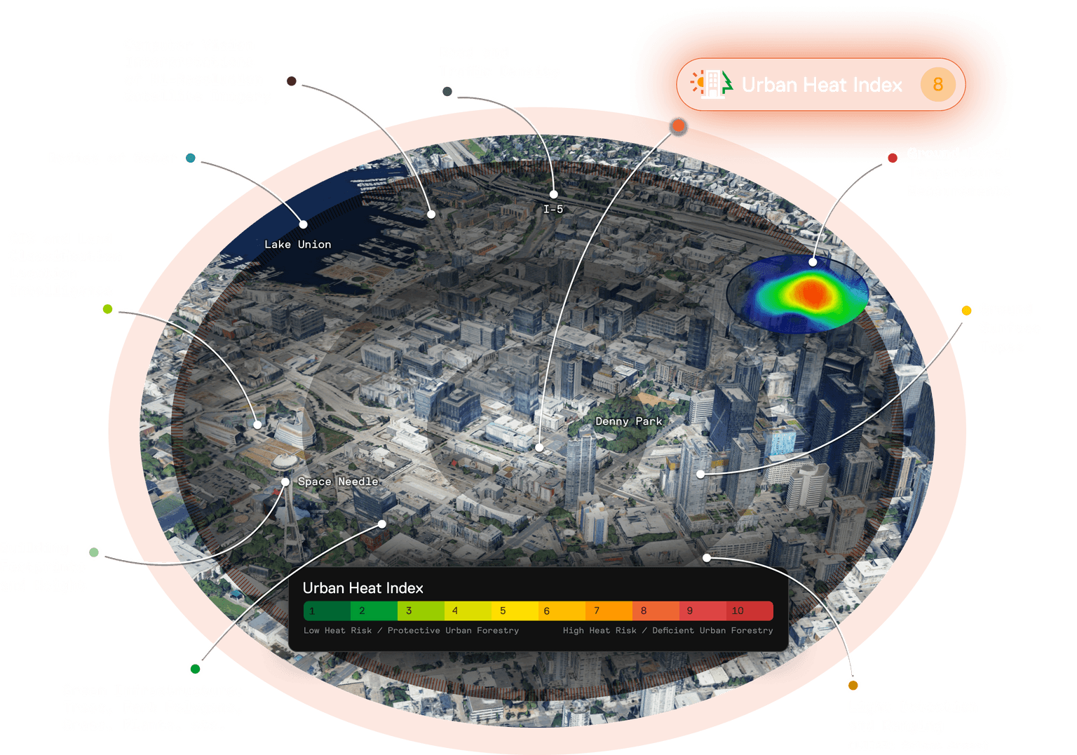
The Urban Heat Index (UHI)
The Urban Heat Index is a uniquely powerful tool for identifying and combating urban heat at scale.
The NatureScore Urban Heat Index was developed by combining CAPA Strategies's groundbreaking-empirical measurements of ambient air temperatures across the U.S. with NatureQuant's industry leading natural and built element location intelligence. The UHI draws on the most comprehensive and accurate measurements of ground level air temperature worldwide.
While urban heat measurements can occur through stationary sensors, which are limited in spatial resolution, or satellite derived approaches, which are limited in temporal resolution, CAPA's approach is superior to any available heat measurement due to its spatial and temporal completeness.
The NatureScore Urban Heat Index combines urban ground level temperatures (taken at 2 meter heights at three consistent periods during the day: morning, afternoon, and evening) and numerous measures of natural and built elements (live bio-mass, impervious surfaces, building footprints and heights, bodies of water, densities of highways, etc.). The combined environmental and heat intelligence are run through an AI process to powerfully predict where and why urban heat islands are formed.
In short, the Urban Heat Index is a metric used to assess how well a specific area can regulate higher temperature associated with dense urban environments.

What do NatureScore® Urban Heat Index scores mean?
The NatureScore Urban Heat Index provides a single score from 1 (low priority) to 10 (high priority) by census block (a “neighborhood”) or single point. A score of 1 indicates the lowest level of heat risk while a score of 10 indicates the highest level of heat risk*. Neighborhoods with high NatureScore Heat Index scores should be prioritized for green infrastructure development, one of the most affordable and effective ways to mitigate heat risk. All NatureScore Heat Index scores are city relative, meaning each measurement is compared only to the subject urban zone, not nationwide.
*Heat risk is meant to convey places where the environment is contributing to excessively high temperatures and action is needed, rather than a place where people may not have air conditioning or other ways to cool down. Note that socioeconomic and demographic information can be layered upon the UHI to find vulnerable populations.
In Partnership With

Contact Us
Stay Informed
Product updates and company news delivered right to your inbox.
Send Email
We want to hear from you. Send any press, scientific, or general inquiries our way.
info@naturequant.com